Mitchell River Topographic Map 1:50k - 4068-4
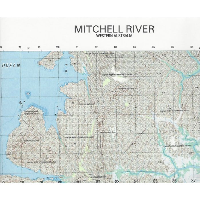
Mitchell River, 4068-4, 1:50,000 scale army topographic map covering Mitchell River estuary and surrounds including Mitchell River tidal rapids, Surveyors Pool and Swift Bay in Kimberley region, Western Australia.
In stock
SKU
4068-4
$12.00

Related Products
Check items to add to the cart or
| Description | Mitchell River 1:50,000 scale topographic map, 4068-4, 1st edition, 2003, DIGO (Australian Army). |
|---|
Write Your Own Review