Warrender Topographic Map 1:50k - 4068-1
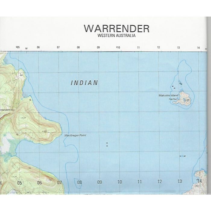
Warrender 4068-1, 1:50,000 scale (2cm=1km) topographic map covering Port Warrender, Lawley River estuary, Crystal Creek and eastern Mitchell Plateau in Western Australia's Kimberley region.
In stock
SKU
4068-1
$12.00

Related Products
Check items to add to the cart or
| Description | Warrender 1:50,000 scale Army topographic map, 4068-1, 2003, Datum WGS84, DIGO. |
|---|
Write Your Own Review