Tumbarumba Topographic Map - 8526-3N
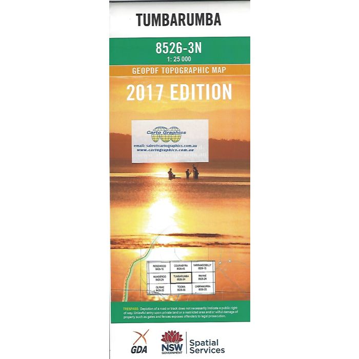
Tumbarumba, 8526-3N, 1:25,000 scale (4cm=1km) topographic map covering Tumbarumba township and the area to the south east including parts of Bago & Maragle State Forests, Bogandyera & Clarkes Hill Nature Reserves extending to the edge of Kosciuzsko National Park.
In stock
SKU
8526-3N
$16.70


Related Products
Check items to add to the cart or
| Publisher | LPI |
|---|---|
| Description | Tumbarumba 125,000 scale topographic map, 8526-3N, 2017 Geopdf edition, LPI NSW. This map can be laminated and refolded for extra durability in the field. |
Write Your Own Review