Courabyra Topographic Map - 8526-4S
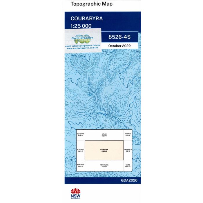
Courabyra, 8526-4S, 1:25,000 scale NSW topographic map covering mostly Bago State Forest northeast of Tumbarumba, includes a section of Hume and Hovell Waling Track.
In stock
SKU
8526-4S
$16.70


Related Products
Check items to add to the cart or
| Publisher | LPI |
|---|---|
| Description | Courabyra 1:25,000 scale topographic map, 8526-4S, 2022 Geopdf edition, LPI NSW. |
Write Your Own Review