Lambell Topographic Map - 5469-4
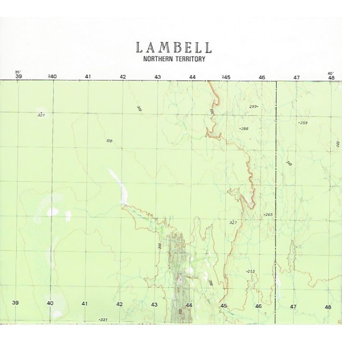
Lambell, 5469-4, 1:50,000 scale topographic map covering Katherine Riverupper reaches and surrounding area including eastern portion of Nitmiluk National Park. Note: Datum AGD66, adjust your GPS as required.
In stock
SKU
5469-4
$12.00

Related Products
Check items to add to the cart or
| Description | Lambell 1:50,000 scale topographic map, 5469-4, 20m contour, datum AGD66, Australian Army, 1982. |
|---|
Write Your Own Review