Hornsby Topographic Map - 9130-4S
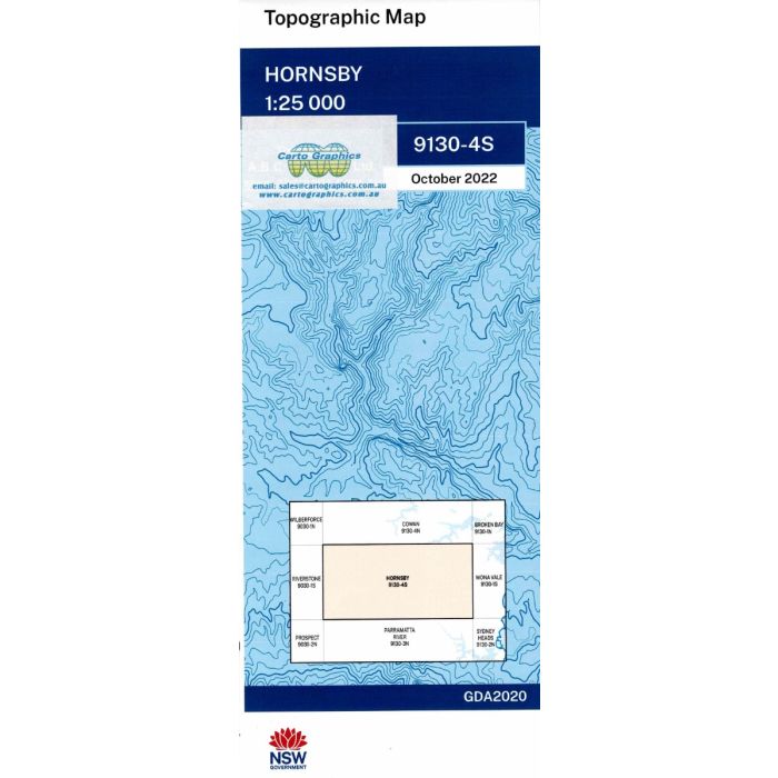
Hornsby, 9130-4S, 1:25,000 scale (4cm=1km) topographic map covering the district around Hornsby including Castle Hill, Galston, St Ives, Frenchs Forest, Terrey Hills, parts of Garigal, Berowra Calley and Kuringai National Parks, upper reaches of Cowan Creek and Coal & Candle Creek.
In stock
SKU
9130-4S
$16.70


Related Products
Check items to add to the cart or
| Publisher | LPI |
|---|---|
| Description | Hornsby 1:25,000 scale topographic map, 9130-4S, 2022Geopdf edition, LPI NSW. This map can be laminated and refolded for extra durability in the field. |
Write Your Own Review