Edith River Topographic Map - 5369-4
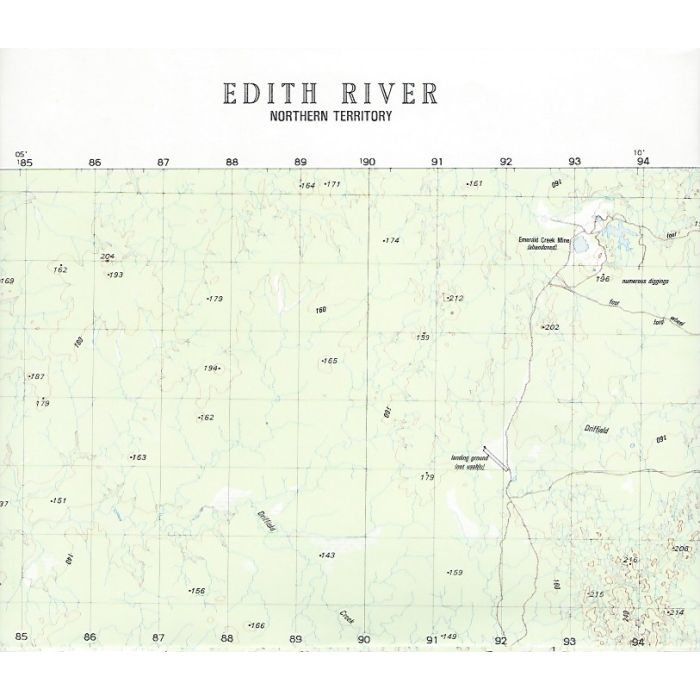
Edith River, 5369-4, 1:50,000 scale (2cm=1km) topographic map covering Edith River covering an area from Stuart Highway east to Nitmikuk National Park including Edith Falls and Mount Todd. This map covers the Edith River section of the Jatbula Trail (trail not shown). Note: Datum AGD66, adjust your GPS as required.
In stock
SKU
Edith River Topographic Map - 5369-4
$12.00

Related Products
Check items to add to the cart or
| Description | Edith River 1:50,000 scale topographic map, 5368-4, 20m contour, Datum AGD66, Australian Army, 1981. |
|---|
Write Your Own Review