Southern Grampians Outdoor Recreation Guide
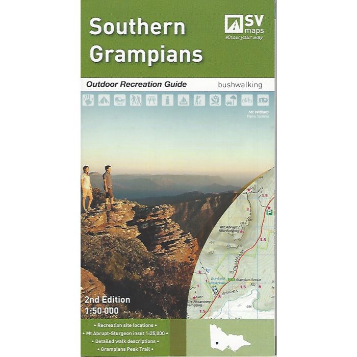
Southern Grampians Outdoor Recreation Guide Map - Spatial Vision. The Southern Grampians recreation guide provides detailed maps for walking, overnight hiking, walking tracks, major activities, car and four wheel touring as well as flora and fauna. Made in conjunction with Parks Victoria.
In stock
SKU
SVGrampS
$19.95


Related Products
Check items to add to the cart or
| Publisher | Spatial Vision |
|---|---|
| Description | Southern Grampians Outdoor Recreation Guide Map - Spatial Vision
SCALE: 1:50,000
COVERAGE: Dunkeld, Wannon, Glenthompson (Southern end of Grampians National Park)
IDEAL FOR: Bushwalking, mountain biking and car touring
SIZE (unfolded): 675mm wide and 1000mm high folded to 135mm x 250mm
The Southern Grampians recreation guide provides detailed maps for walking, overnight hiking, walking tracks, major activities, car and four wheel touring as well as flora and fauna. Made in conjunction with Parks Victoria, the guide also contains information about the many walks (difficulty, distance, time and elevation), major activities and local contact information. These guides replace the Vicmap Outdoor Leisure series of maps. |
Write Your Own Review