Sleisbeck Topographic Map - 5470-2
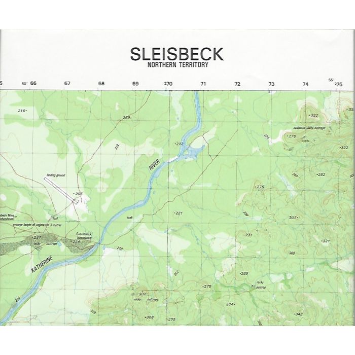
Sleisbeck, 5470-2, 1:50,000 scale Army topographic map covering upper reaches of Katherine River and Birdie Creek, Arnhem Land Plateau, Northern Territory.
In stock
SKU
5470-2
$12.00

Related Products
Check items to add to the cart or
| Description | Sleisbeck Topographic Map, 1:50,000 scale, Datum AGD66, Australian Army, 1985. |
|---|
Write Your Own Review