Nourlangie Creek Topographic Map - 5472-2
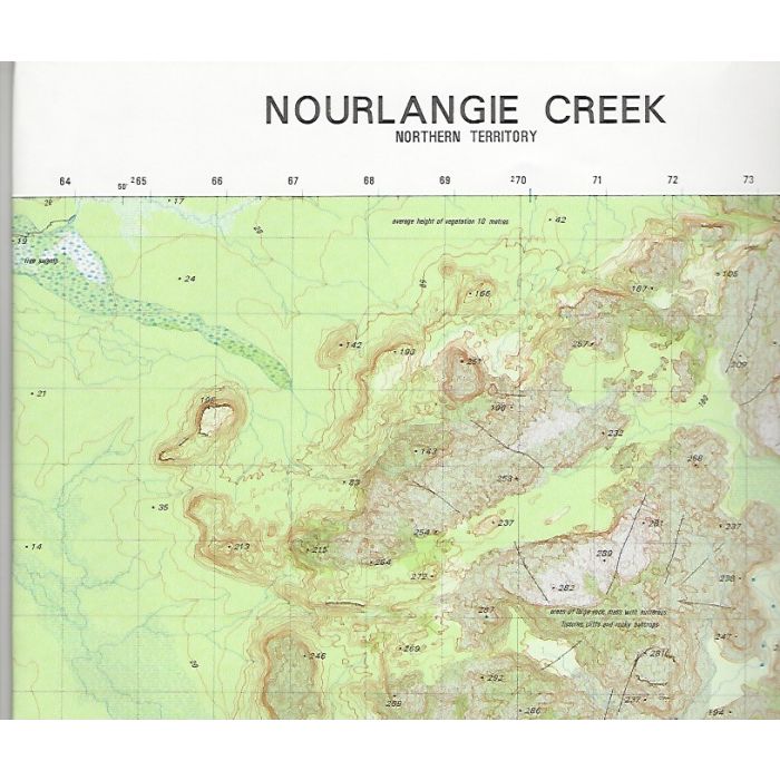
Nourlangie Creek, 5472-2, 1:50,000 scale topographic map covering Namarrgon and Nourlangie Creeks, Koongarra, southern Mount Brockman Plateau, Namarrgon Gorge and adjacent Arnhem Land Plateau in Kakadu National Park, Northern Territory.
In stock
SKU
5472-2
$12.00

Related Products
Check items to add to the cart or
| Description | Nourlangie Creek 1:50,000 scale topographic map, 5472-2, 1st edition, WGS84 datum, 1997, ADF. |
|---|
Write Your Own Review