Western Arthur Tasmap Topographic Map - TR06
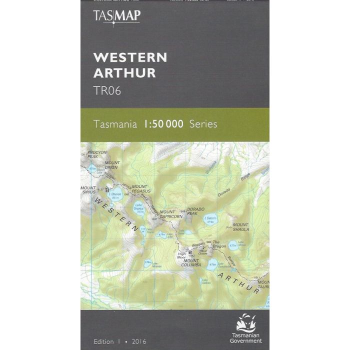
Western Arthur 1:50,000 scale (2cm=1km) topographic map - TR06. 2nd edition, 2022, Tasmanian map covering Western Arthur Range and surrounding Southwest National Park, southern part of Lake Pedder and part of Eastern Arthur Range. Includes McKays Track, Western Arthur Range Traverse, Haven Lake Track, Eastern Arthur Traverse and Port Davey Track.
In stock
SKU
TR06
$12.95


Related Products
Check items to add to the cart or
| Publisher | Tasmap |
|---|---|
| Description | Western Arthur 1:50,000 scale topographic map, TR06, 2nd edition 2022, Tasmap |
Write Your Own Review