Riverland and Murray Mallee - CFS/Emergency Services Topographic Map Book
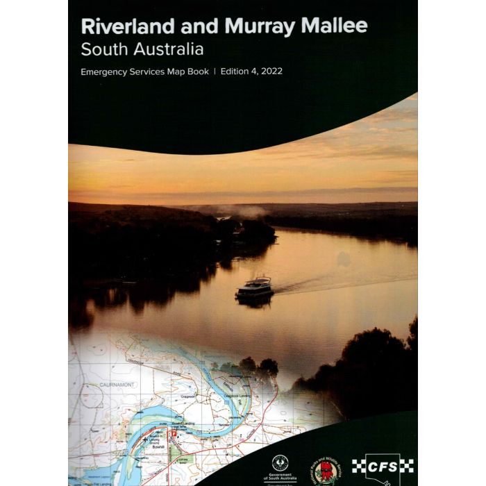
Riverland & Murray Mallee Emergency Services Map Book (often called CFS Mapbook) covers the Murray Mallee region of South Australia from Keith through the Riverland up to Danggali Conservation Park at 1:100,000 scale with full topographic detail. It also includes 1:50,000 scale mapping along the length of the Murray River from NSW border to Lake Alexandrina as well as regional town maps are 1:20,000 scale.
The CFS/SES map books of South Australia are available in 8 different regions. Each shows detailed topographic mapping with full Map Grid of Australia (MGA94)_coordinates for use with GPS (set WGS84 in your GPS). Maps are based on the State Government 1:50 000 scale dataset and are produced at 1:100 000 scale. Mt Lofty Ranges and Kangaroo Island 1:50 000 scale.
In stock
SKU
CFS-Riv
$79.00

Related Products
Check items to add to the cart or
| Description | Emergency Services Topographic Map Book - Riverland & Murray Mallee - often called CFS Book
This volume covers the Murray Mallee region of South Australia from Keith through the Riverland up to Danggali Conservation Park. Includes Murray River, Lower Lakes and most of the Coorong at 1:100,000 scale(1cm=1km). Included town maps are 1:20,000 scale.
The SES map books of South Australia are available in 8 different regions. Each shows detailed topographic mapping with full Map Grid of Australia (MGA94) coordinates for use with GPS (set WGS84 in your GPS). Maps are based on the State Government 1:50 000 scale dataset and are produced at 1:100 000 scale. |
|---|
Write Your Own Review