Lower Portland Topographic Map - 9031-2S
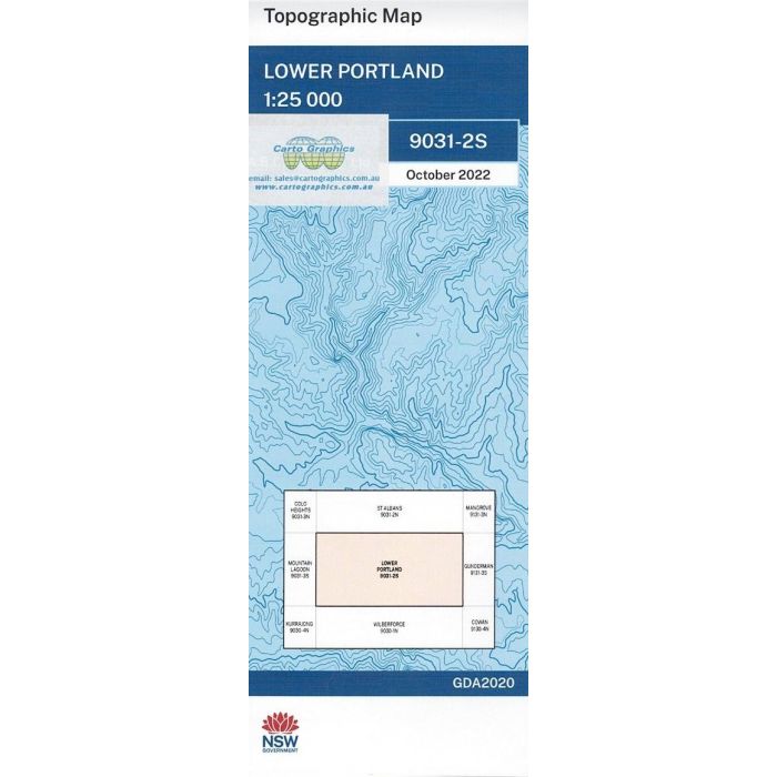
Lower Portland, 9031-2S, 1:25,000 scale NSW topographic map covering the Colo and Hawkesbury Rivers junction, Wisemans Ferry, Maroota Historic Site, Central Colo and sections of Wollemi National Park, Parr State Conservation Area and Comelroy State Forest.
In stock
SKU
9031-2S
$16.70


Related Products
Check items to add to the cart or
| Publisher | LPI |
|---|---|
| Description | Lower Portland 1:25,000 scale topographic map, 9031-2S, LPI NSW, 2022 Geopdf edition. This map may be laminated for extra durability in the field. |
Write Your Own Review