Katherine Topographic Map 50k - 5369-2
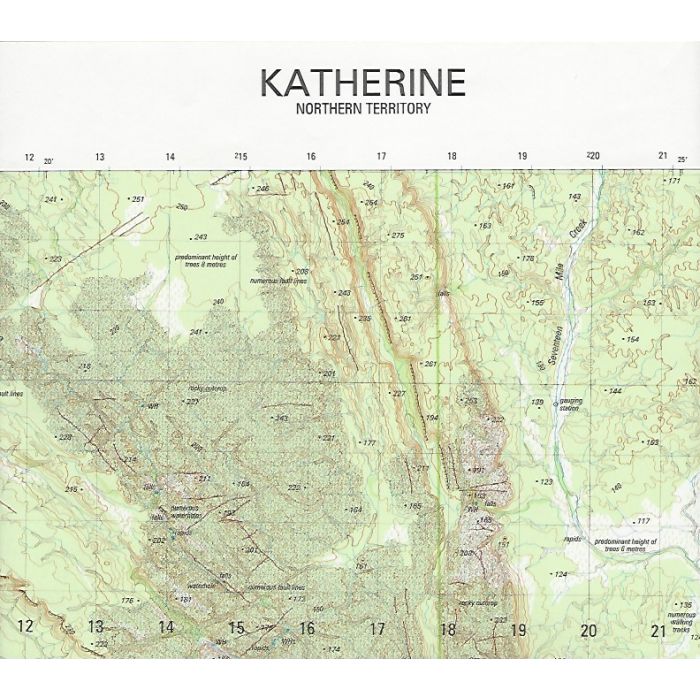
Katherine 1:50,000 scale topographic map, 5369-2, covering Katherine township and the area to the North and East, including Katherine River and McAddens Creek, Katherine Gorge and adjacent Nitmiluk National Park. The map also covers the lower section of the Jatbula Trail area in Seventeen Mile Creek valley up to Biddlecombe Cascades (trail not marked).
In stock
SKU
5369-2
$12.95

Related Products
Check items to add to the cart or
| Description | Katherine, 5369-1, 1:50,000 scale (2cm=1km) topographic map, WGS84, 10m contour, Australian Army, 2005. |
|---|
Write Your Own Review