High Country North East Map - Hema Maps
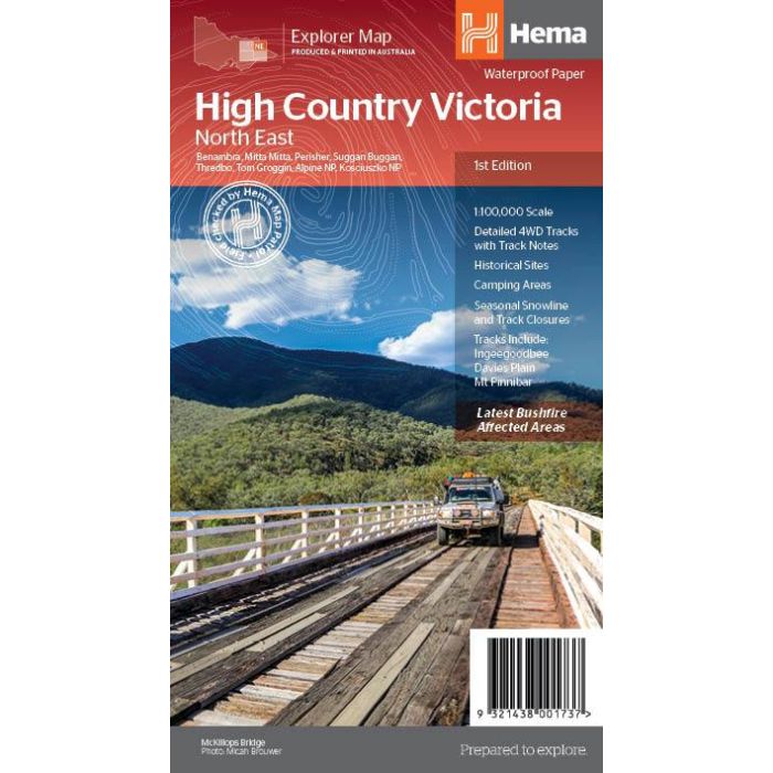
High Country Victoria North East map from Hema Maps covering the Victorian and NSW alpine areas around Benambra, Kosciuszko, Mitta Mitta, Murray River Source, Perisher, Suggan Buggan, & Tom Groggin. 1:100,000 scale
In stock
SKU
Hema HCNE
$14.95


Related Products
Check items to add to the cart or
| Publisher | Hema Maps |
|---|---|
| Description | Victorian High Country North East map sheet, covering the the area from Omeo and into NSW as far as Jindabyne. Printed on durable waterproof paper, this map features Hema's iconic mapping and extensive points of interest. Featuring roads and 4WD tracks field-checked by the Hema Map Patrol for superior accuracy. It combines Hema’s entire database of roads and 4WD tracks with touring points of interest and topographic information. Also included are seasonal track closures, camping areas, old townsites, huts, accommodation and distances. Key Features 4WD tracks Huts Camping areas Old townsites Seasonal track closures Road distances Accommodation 1st edition, 2020 |
Write Your Own Review