Goodparla Topographic Map - 5371-2
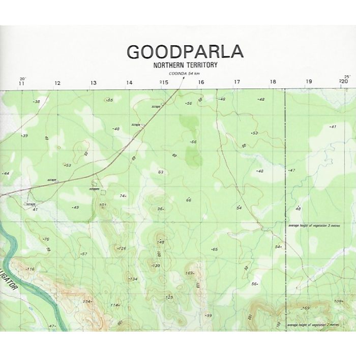
Goodparla, 5371-2, 1:50,000 scale Army topographic map covering South Alligator River from Gerowie Creek to Kambolgie Creek, Gunlom Falls, Maguk (Barramundie Gorge) and Old Goodparla Station in Kakadu National Park.
In stock
SKU
5371-2
$14.95

Related Products
Check items to add to the cart or
| Description | Goodparla 1:50,000 scale topographic map, 5371-2, 1st edition, 1988, Datum AGD 66, Australian Army. |
|---|
Write Your Own Review