Bright- Mansfield Adventure Map - Rooftop
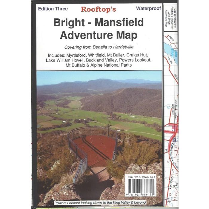
Bright-Mansfield Adventure Map from Rooftop Maps. 1:100,000 scale topographic map covering Benalla to Harrietville including Myrtleford, Whitfield, Mt Buller, Craigs Hut, Lake William Hovell, Buckland Park, Powers Lookout, Mt Buffalo & Alpine National Parks. Bright-Whitfield Forest Activities 1:50,000 scale map on reverse side. Printed on durable, waterproof paper.
In stock
SKU
RF BM
$14.95


Related Products
Check items to add to the cart or
| Publisher | Rooftop Maps |
|---|---|
| Description | Bright-Mansfield Adventure Map, 1:100,000and 1:50,000 scale, 3rd edition. Printed on durable, waterproof paper - Rooftop Maps |
Write Your Own Review