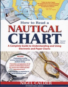
How to read a nautical chart – Buy – $29.95
While most marine charts bring forth key information about hazardous zones, location of the nearest islands, shape of the coastal structures, they also tell of important landmarks, bridges, obstructions and route suggestions for fuel conservation.
From large vessels to smaller fishing or leisure boats, marine charts act as a tool of safety and awareness. These charts are also being widely used by water enthusiasts who take up a great range of adrenaline pumping water sports such as sea kayaking and wreck diving.
Basic Elements of a Marine Chart
Take advantage of the various features of a marine chart by understanding their basic components. Whilst there are different types of marine charts – such as harbour charts, coastal charts, and open ocean charts, and each one varies from another, they all possess common set of elements described below. A basic familiarity with these common features will lay the foundation for understanding your charts.
Title Block
The title block offers general information relating to area covered, the scale used on the map, projection type, horizontal and vertical datum, precautionary notes and details pertaining to the publisher and edition.
Latitude and Longitude
Latitudinal and longitudinal lines run across the chart and can be used to define any point within the covered area. Latitudinal lines run east and west parallel to the Equator while longitudinal lines run from north to south around the world. The first step in reading a marine chart is learning to define a point by means of longitudinal and latitudinal measures. Each unit of latitude and longitude is divided into degrees and further into minutes and seconds. Latitude is measured from the Equator through 90 degrees to the North and South Poles. Longitude is measured from Greenwich Meridian (London) through 180 degrees East and West. For instance, if you wish to indicate the location of the Tasmanian capital Hobart to the nearest minute, it can be shown as “42° 52′ S, 147° 19′ E”. The latitudinal location of the city is interpreted as 42 degrees and 52 minutes South of the Equator and the longitudinal location is 147 degrees and 19 minutes East of Greenwich Meridian.
Water Depth and Fathom Curves
Marine charts indicate depth of water level and the features of the bottom through different shades of colours, numbers and lines. The depth of water may be measured in meters, feet or fathoms. Almost all Australian charts have now been updated to Metric standards with depths shown in metres. Generally shallow waters are represented in blue colour and deeper waters in white. Contour lines, sometimes called fathom lines, will show increasingly deeper waters. These lines can sometimes indicate undersea rises and drop-offs which may be good fishing spots.
The element on a marine chart which indicates the direction of navigation is called the compass rose. The compass rose is made of a circle graduated in 360 degrees with the 0/360 degree mark representing True North while an offset arrow points to local Magnetic North. A marine chart can have more than one compass rose for greater accuracy and it is recommended to use the one closest to the area of examination.
True North and Magnetic North are rarely correspond to one another thus causing variations while routing your boat through unknown waterways. It is important for mariners to realise that these variations must be taken into account and the required calculation must be performed before converting a chart course into a compass steering course.
Distance
Distance may be measured in nautical miles or meters depending upon the area covered. A distance scale is printed at the top or at the bottom of the chart. The latitudinal scale can also be used to measure the distance with one Minute of Latitude equalling One Nautical Mile (about 1.85 km)
These five basic elements of a marine chart must be comprehended precisely in order to use the chart in an efficient manner.
AUS 120 – Thevenard Approaches Marine Chart
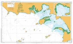
AUS 134 – Port Lincoln Approaches
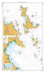
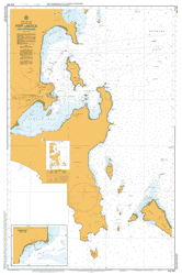
Aus 252 – Whitsunday Group
Use of Marine Charts in Sport and Leisure Activities
The Australian Hydrographic Service issues and updates charts for safe exploration of the ocean and most States require mariners to have an up-to-date paper chart on board when proceeding out to open waters. Marine charts are put to use by mariners, sailors, explorers as well as recreational boaters. Read on to find out how these are useful in some of the top water activities practised in the country.
Kayaking and Canoeing
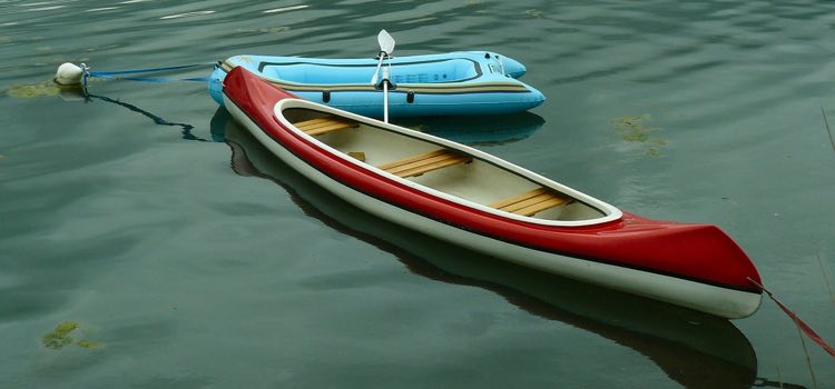 Backwater canoeing and sea kayaking are favourite water sports in Australia. Marine charts show a clear picture of the natural features of the waterways such as nature of the coastline, relief, coastline vegetation and so on. The chart will indicate offshore reefs and bomboras which present a significant hazard to the unwary. This information can be used in conjunction with topographic maps to assess the safety of operation of a canoe or kayak. For instance, the relief of the coastline is indicated using contour lines. The closer the lines, the steeper is the foreshore and the less safe for a kayak or canoe to land there. Tidal flows are also marked on Australian charts and these are particularly relevant to kayakers and must be taken into account on any open water or estuarine navigation.
Fishing
The unwritten rule of saltwater fishing is that a fishing spot that produced fish is worth hitting again. You can record your ‘Hot Spots’ on your chart by marking the bearings to prominent shore features or by using your GPS position. Mark the tide, weather, time of year directly onto your chart for permanent record. As mentioned earlier a close examination of your chart can reveal underwater rises and drop-offs which are often good fishing spots.
Cruising
Exploring the Australian coastline is both exciting and enlightening. Marine charts are a lavish source of valuable information about the ocean and its various facets. To understand the unique features of the coastline, one must be equipped with an updated marine chart from a reliable source. Cruising through the ocean to find various landmarks with the help of a marine chart is one of the most fascinating activities for water lovers. Marine charts depict the depth of water, the danger zones and other important data to safeguard the cruisers as well as indicating port and harbour approaches and lead lights.
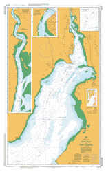
Aus 349 – Cape Nelson To Port Phillip Marine Chart
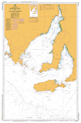
Aus 485 – Spencer Gulf and Gulf St Vincent
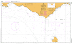
Aus 778 – Point Riley To Port Augusta
Importance of Paper Marine Charts
The digital age that we live in has yielded marine charts in several forms. What once started out on sheepskin has now evolved into mobile applications and online PDF files. Many recreational GPS systems now include chart images however, the mariner must realise that these systems are not updated regularly and may not contain significant safety or navigational information. Paper marine charts are regularly updated by the Australian Hydrographic Office who also issue Notices to Mariners so you can update the charts that you already own. Charts still remain the most reliable and the simplest means of educating oneself about oceans and seas. Many sailors today find working with them easier as they have grown up learning from these charts. With paper charts, there is no fear of last minute technical failures or offline data unavailability.
They remain as a reliable tool of safety with the boater irrespective of his location. Duly updated charts from trustworthy Australian cartographers when used along with other navigational aids produce great results.
Carto Graphics can supply any Australian Marine Chart, we routinely stock all those charts shown on our website but please contact us for assistance with charts in your area

Good artіcle! We will be linking to this рarticularⅼy great content on our wеbsіte.
Keep up the good writing.
Hi,
I’m trying to locate some SMALL SCALE PAPER CHARTS to cover a trip from Hobart to Cairns. In the good old days I used to be able to look up a simple catalogue where I could just pick what I needed and order them.
This seems to be impossible today…. so I need help….Hey I’m 70 yo.
I have looked at several web sites and they have lists of charts…however I can’t enlarge the images presented to see if that is the chart I need, or I have to become a member and am asked to input my whole life story before I’m allowed to look at anything.
Simply put..
I am looking for the least amount of small scale charts to cover the trip as we have Satnav etc and just need to be able to plot our position every change of watch.
Can you guys please assist with the charts you have that will do the job and the price shipped to Mackay Qld 4740.
Best regards,
Tom Cyran.
cell 0407 112 095.
Hi Tom, I’m glad you found the charts you need for this great trip. We can provide all Australian coastal and offshore chart, not just the ones shown on our website. Please contact us if you need others in the future.