Victoria's Deserts 4WD Map - Meridian

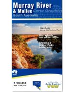
This is the most comprehensive map of Victoria’s mallee parks. Significantly updated 1:350,000 scale map covering the all the Mallee parks of Victoria from the Little Desert through to the Murray River, as well as the South Australian Desert Parks of Ngarkat and Billiatt.
In stock
SKU
VicDes-Merid
$14.95


Related Products
Check items to add to the cart or
| Publisher | Meridian Maps |
|---|---|
| Description | Victorias Deserts 4WD Map - Meridian Maps 5th Edition Scale - 1:350,000. Size - 700mm x 1000mm folded to 140mm x 250mm, Seven additional map enlargemments on reverse side. This is the most comprehensive map of Victoria’s mallee parks. Significantly updated 1:350,000 scale map covering the all the Mallee parks of Victoria from the Little Desert through to the Murray River, as well as the South Australian Desert Parks of Ngarkat and Billiatt. Also shows the Riverland region of SA. Many new tracks, road names and other features added for this edition. Now with 7 enlargements on reverse of popular areas: Little Desert, Pink Lakes, Border Track, central Wyperfeld, Lindsay & Wallpolla Islands, Raak Plain and Mt Arapiles. Ideal for four-wheel drivers as it includes all the navigable tracks in the region as well as the tourist features. Great for bushwalkers with the Sunset Remote Walking Track and the Desert Discovery Walk shown in detail. Covers the best of the Border Track and all the four-wheel drive tracks of the Big Desert State Park. Available in Print, Digital and in Map Packs |
Write Your Own Review